Kaum zu glauben, aber wahr: im Oktober 2015 begann die Geschichte von creatologyblog! Zur Feier des Tages habe ich Euch unten für jedes Jahr einen besonders gelungenen Beitrag verlinkt. Viel Spaß beim Stöbern!
This month, creatologyblog has its 10th anniversary! So, I’ve chosen one of the best posts from each year for you to explore by clicking on the links below. Have fun!
Hier auch einen ganz herzlichen Dank allen Lesern, die meinen Blog entdeckt haben, ihm treu geblieben sind und besonders jenen, die ab und zu ein like oder einen Kommentar da lassen! Viele Grüsse aus Augsburg – und hoffentlich auf die nächsten 10 Jahre!😉
Also, this is a perfect occasion to say „thank you so much!“ to all readers that have discovered my blog, are following it and most of all for any likes or comments! Greetings from Augsburg – and (hopefully) cheers to another 10 years!😉
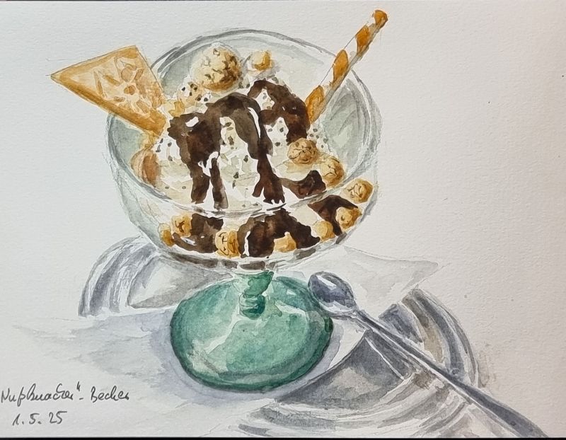
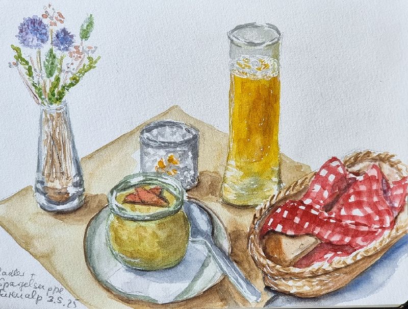
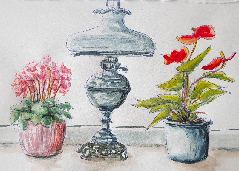
In letzter Zeit habe ich mal wieder zum Sketchbuch und den Aquarellfarben gegriffen. Das Bild oben entstand am 1. Mai – ich habe es vor Ort gemalt. Den Eisbecher unten gab es zwar am selben Tag, doch er ist vom Foto gemalt: ich bin nicht schnell genug, um so etwas vor dem Schmelzen zu zeichnen…
Lately, I’ve done some watercolour sketches in my book. The one above has been done First of May, during a short bike trip. The ice bowl below, on the same day, but from a photo – I’m not fast enough to do a sketch before it melts…
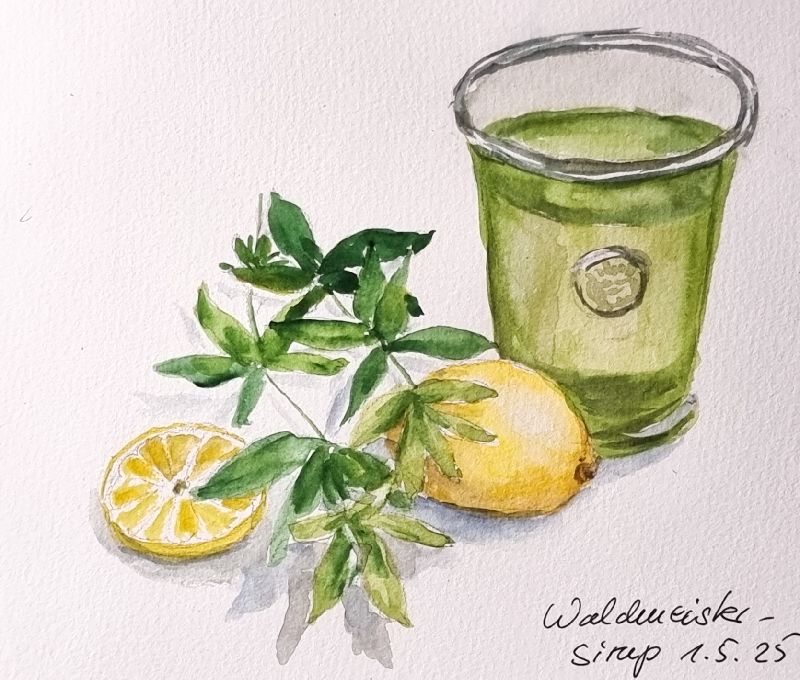
Erstmals habe ich dieses Jahr Waldmeistersirup gekocht und auch dies im Büchlein festgehalten – direkt abgezeichnet, ohne Foto. Dafür hatte ich extra Zitronen und 2 Zweiglein Waldmeister aufgehoben.
This year, I’ve made woodruff syrup for the first time and done the sketch from the arranged stilllife – having saved two stems of woodruff for this sketch.
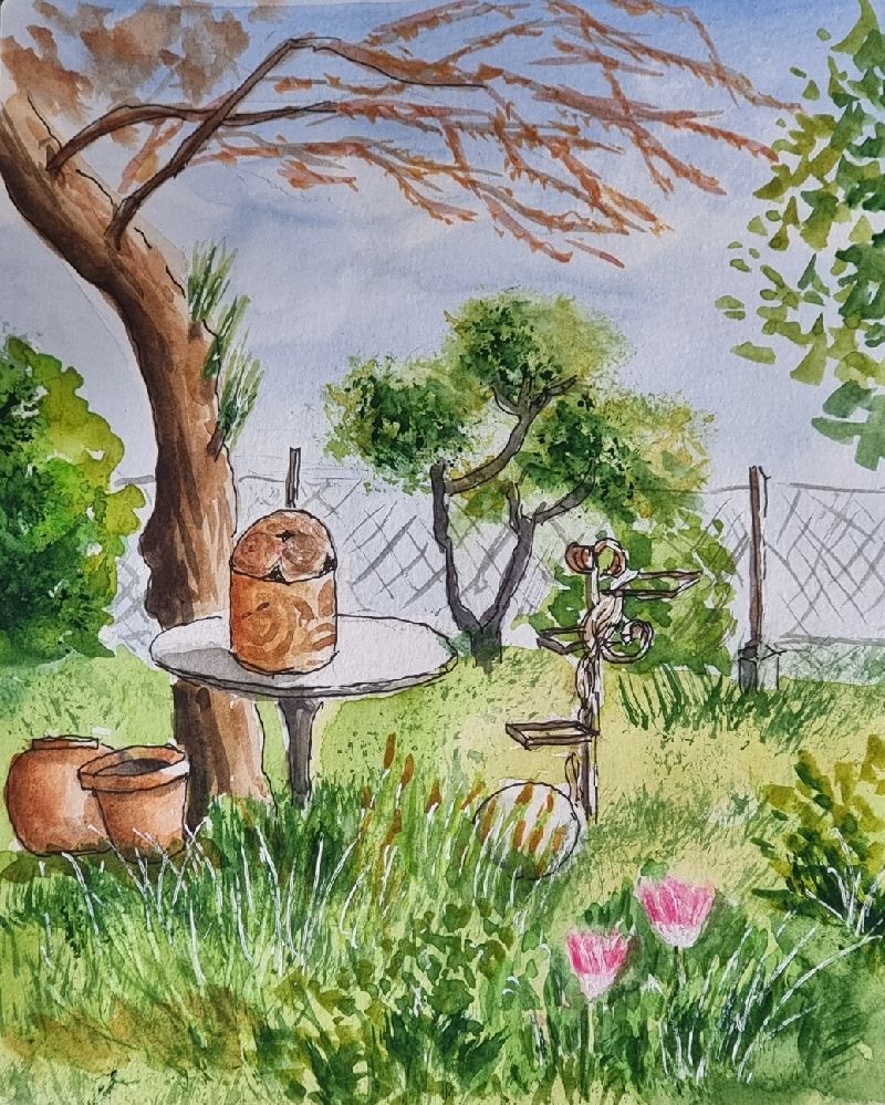
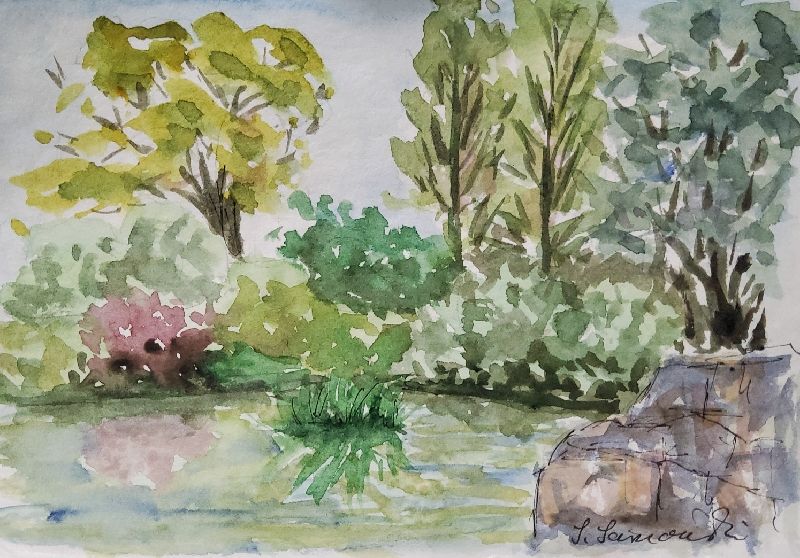
Eine kleine Ecke im Garten einer Freundin musste auch Modell stehen:
A small corner in a friend’s garden had me inspired, too:
Und dies Wochenende im Engelberger Tal bei meiner Tochter, gab es auch viele Motive. Leider war es draußen zu kalt und teils feucht, sodass nur das Bild in der Gastwirtschaft direkt gezeichnet ist, die beiden anderen von Fotos.
This weekend at my daughter’s in Engelberg also offered a lot of motives. Alas, the weather was too cold and rainy for sketching outside, so I only did the one in the restaurant on location, the others from my photos.
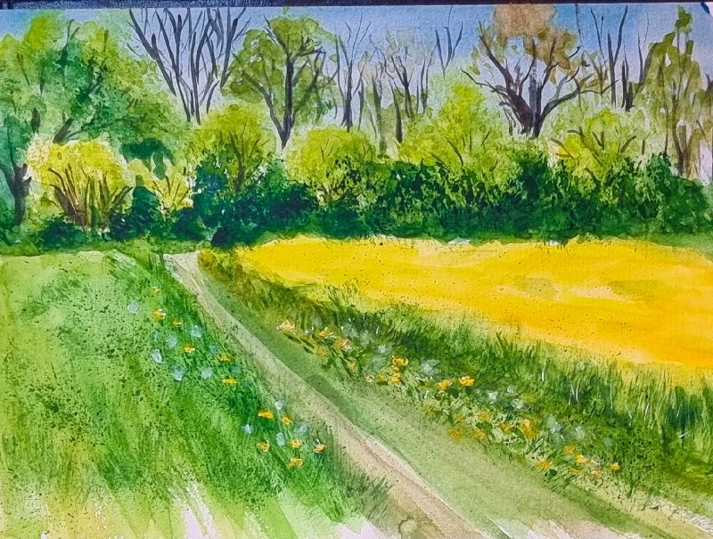
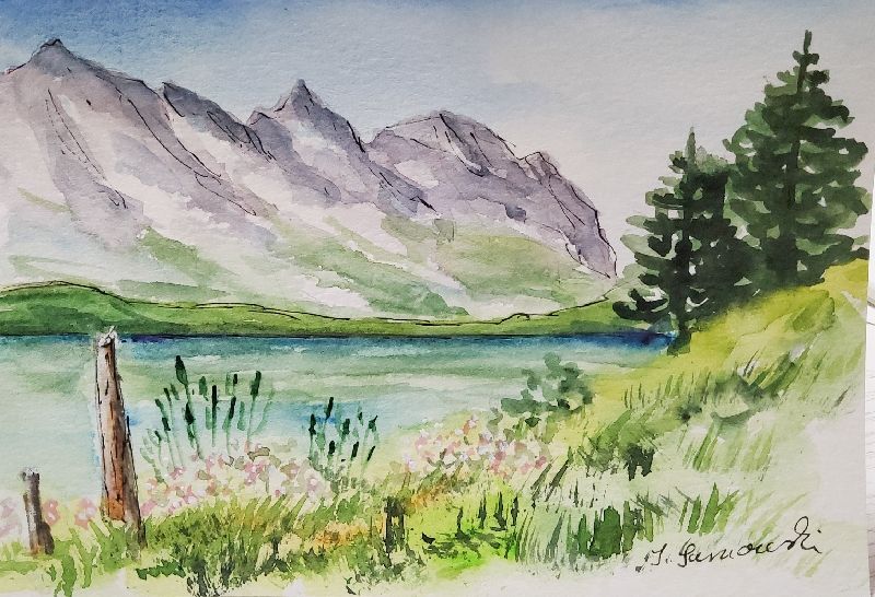
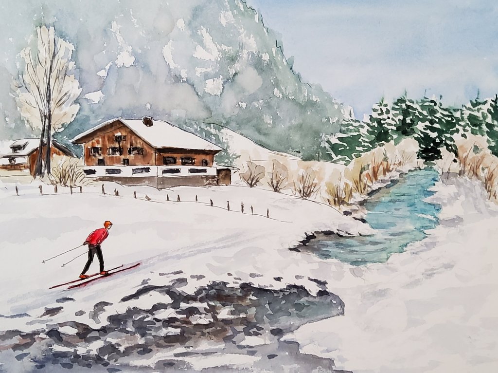
Den heutigen, regnerischen Feiertag habe ich endlich mal wieder mit den Aquarellfarben verbracht. Zum Üben wollte ich ein paar kleine Landschaften malen, wo Feder bzw. Feinliner gar nicht oder nur sehr sparsam zum Einsatz kommen sollten.
On this rainy Twelfth Day I felt like some watercolour practice. So I did some small landscapes either without line or only used sparingly.
Im Landkreis Friedberg/near Friedberg, Bavaria
Statt in mein Sketchbuch habe ich sie auf einen Aquarellblock gemalt, den ich dafür in kleinere Rechtecke unterteilt habe. Für letztere habe ich das Format B6 gewählt, das entspricht etwas größeren Postkarten, damit ich sie auch als solche verwenden kann.
Instead of painting in my sketchbook, I used a watercolour pad on which I outlined rectangles in a German postcard format so I can use the watercolours as postcards.
Für das Bild oben habe ich ein Haus von einem alten Foto genommen und in eine fiktive Berglandschaft gesetzt.
In the picture above I’ve „taken“ a house from an old photo and put it into a fictitious mountain landscape.
Kassel: Szene im Bergpark/scene in the mountain park
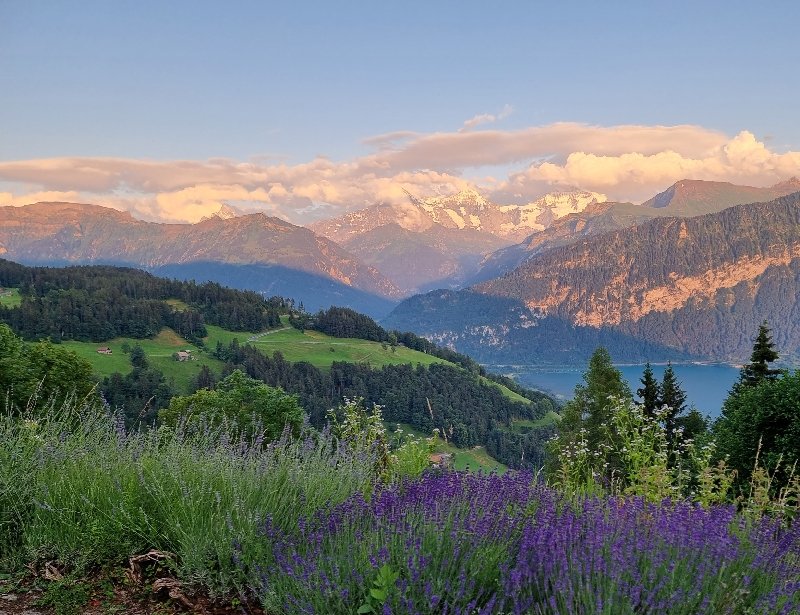
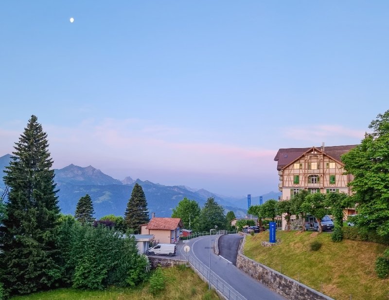
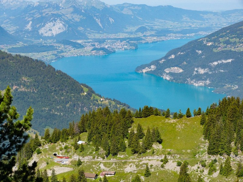
Am zweiten Juliwochenende hatte ich auch den Freitag frei und da bestes Wetter war, fuhr ich bereits Donnerstagabend in die Schweiz. Zunächst nach Beatenberg am Thuner See (Nähe Interlaken). Bereits hier hatte ich ein tolles Panorama im Abendlicht:
The second weekend of July I already had the Friday off. So, with great weather forecast, I started Thursday in the afternoon for Switzerland. First, I went to Beatenberg on Lake Thun (near Interlaken), where I enjoyed the panoramic view in the evening:
Die weißen „Häupter“ im Hintergrund sind Eiger, Mönch und Jungfrau.
The snowy mountains in the background are Mounts Eiger, Monk and Virgin.
Und bevor ich am nächsten Morgen Richtung Wilderswil startete, gab es wieder hübsche Motive:
And just before driving to Wilderswil the next morning, I took these pictures:
6.00 früh steht noch der Mond über Beatenberg/at 6am the moon still looks down on Beatenberg
Ab Wilderswil nahm ich die Zahnradbahn, die in ca. 50 Minuten die „Schynige Platte“ erklimmt, einen Berg, der auf einer Flanke eine Gesteinsplatte zeigt, die, von der Sonne beschienen, leuchtet (scheint), daher der Name. Vor allem aber hat man von dort oben einen tollen Blick auf’s Jungfraumassiv, den Thuner See und alle umliegenden Berge.
In Wilderswil I took the funicular railway to reach the „Schynige Platte „, a mountain known for the panoramic view of the surrounding mountains and Interlaken with Lake Thun. The ride goes slowly, takes 50 minutes, but already from the train you can enjoy the views.
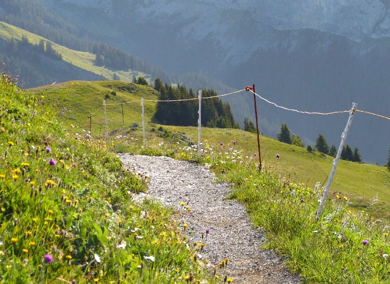
Von der Bergstation aus gibt es etliche Wanderwege/from the upper terminus you have a variety of hiking trails to choose from
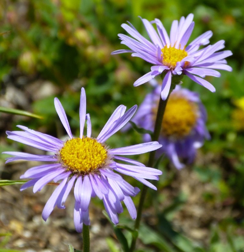
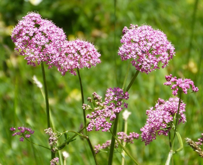
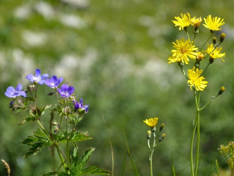
Wunderschön im Sommer ist immer auch die Alpenflora!
Summer in the mountains also always means beautiful flowers everywhere!
Blick auf den Thuner See/view of Lake ThunBergaster/mountain asterHyazinthenblütige Anemone
Auch einen ausgedehneten Alpengarten gibt es dort oben, wo die Pflanzen vorgestellt werden. Der Eintritt ist kostenlos.
There also is a large alpine botanic garden where you can identify the plants. No entry fee.
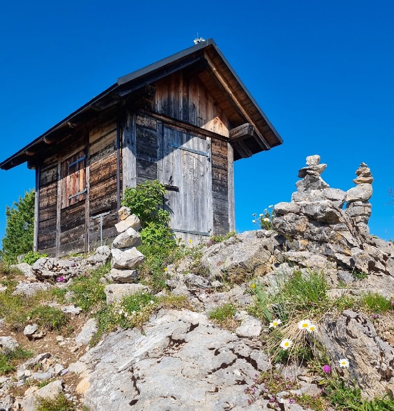
Hütte am Aussichtspunkt „Daube“/little cabin at the view point called „Daube“Hier habe ich dann auch mein Sketchbuch herausgeholt!/here, I filled a spread in my sketchbook!Um die Zeichnung und das Motiv gemeinsam auf’s Bild zu kriegen, musste ich sowohl mit Perspektive als auch mit Belichtung Kompromisse machen…/to get the view and the sketch in the picture together, I had to compromise as for the perspective and the exposure…Auf dem Weg zur „Daube“/trail to the view point
Nachmittags fuhr ich dann mit dem Auto weiter nach Engelberg zu meiner Tochter.
In the afternoon I drove to Engelberg to visit my daughter.
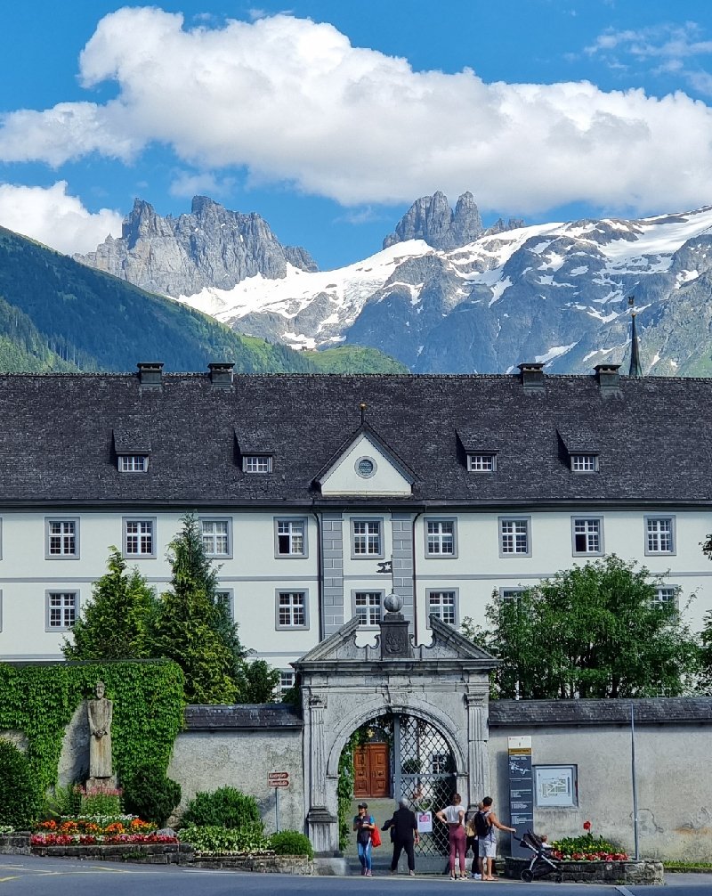
Kloster Engelberg, im Hintergrund Groß- und Klein Spannort/Engelberg monastery, the dented mountains in the background are called Groß (big) Spannort and Klein (small) SpannortIn den Straßen von Engelberg/the streets of Engelberg Die Aa im Engelberger Tal/creek in the Engelberg Valley
Am Samstag machte ich mit meiner Tochter und ihrem Hund Remy einen ausgedehnten Spaziergang um den Trübsee. Dieser liegt auf (ungefähr) halber Höhe hinauf zum Titlis – wir fuhren mit der Seilbahn.
On Saturday, my daughter and her dog Remy took me on a cable car ride halfway up mount Titlis for a long walk around lake Trübsee.
Ist es nicht wunderschön dort?/isn’t it beautiful up there?Remy liebt es jedenfalls!/well, Remy likes it, too!Und die Kälber fühlen sich auch wohl…/ as do the calves…Natürlich habe ich auch diesen Eindruck als Aquarell umgesetzt. /Of course, I had to catch these impressions in a watercolour, too.
Zum Üben von Felsen und Steinen habe ich zwei Motive aus dem Tessin ausgesucht; beide zeigen das Verzascatal. Oben: Wanderweg in der Flussaue; unten: direkt an der Verzasca – die grün-türkise Farbe ist typisch für diesen Fluss (das ist nicht die Spiegelung der umgebenden Vegetation, sondern der Mineralgehalt).
For practising stones and rocks in watercolour, I’ve chosen two scenes from my trip to Ticino. Both show the valley of the Verzasca. Above: trail in the river meadows; below: in the river bed. The green-turquoise colour is typical for this river (it’s not a reflection of the surrounding vegetation but the content of minerals).
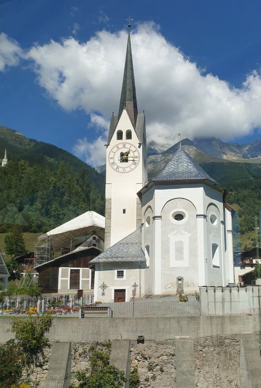
Diese kleine Zeichnung entstand nach einem Foto, das ich aus dem fahrenden Zug gemacht hatte (Glacier Express von Chur nach Zermatt). Daher war das Bild etwas verwackelt und hatte Spiegelungen drin, doch all das sieht man auf der Zeichnung natürlich nicht!😉
This small sketch has been done from a reference photo taken on my trip from Chur to Zermatt by train. The original is a bit blurry, so I decided to do a sketch instead!😉
Fotos von meiner Woche im Tessin letztes Jahr werden mir immer wieder schöne Malvorlagen bieten. Oben: Blick durch einen Teil der „Römischen Brücke“ bei Lavertezzo. Unten: Hafen von Ascona, Lago Maggiore.
Pictures taken during my stay in Ticino last year continue to provide great reference photos for sketching and painting… Above: looking through a part of the „Roman Bridge“ at Lavertezzo. Below: harbour/marina of Ascona, on Lago Maggiore.
Das Bild oben enstand nach einem Foto aus dem Engelberger Tal, das mir meine Tochter geschickt hat, allerdings habe ich es frei umgesetzt. Unten noch eine kleine Zeichnung, die ich bei meiner Mutter angefertigt habe: ich hatte mein Malzeug nicht dabei und habe dann mit einem alten Aquarellkasten meines Vaters gearbeitet: weder Papier noch Pinsel waren eigentlich für Aquarell geeignet, aber es war interessant, zu improvisieren.
The picture above is a free interpretation of a reference photo taken in the Engelberg Valley by my daughter. Below a small sketch I’ve done at my Mum’s place – not having brought my equipment, I’ve used an old watercolour palette of my father’s, as well as paper and brushes which actually weren’t suitable for watercolour. But it was a challenge to improvise.
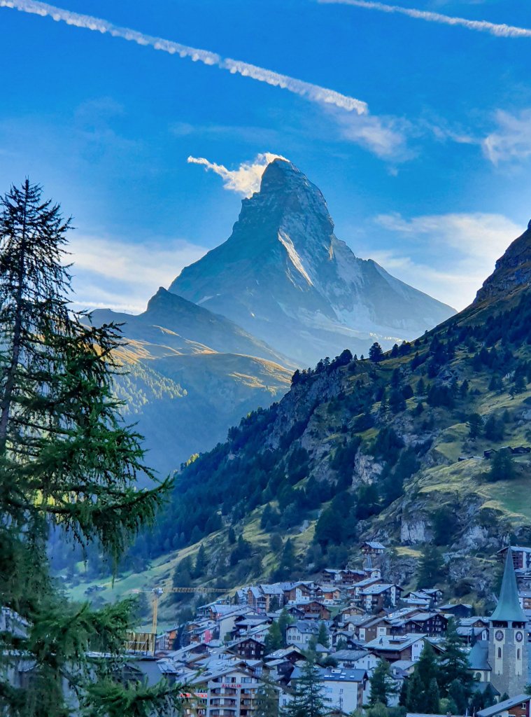
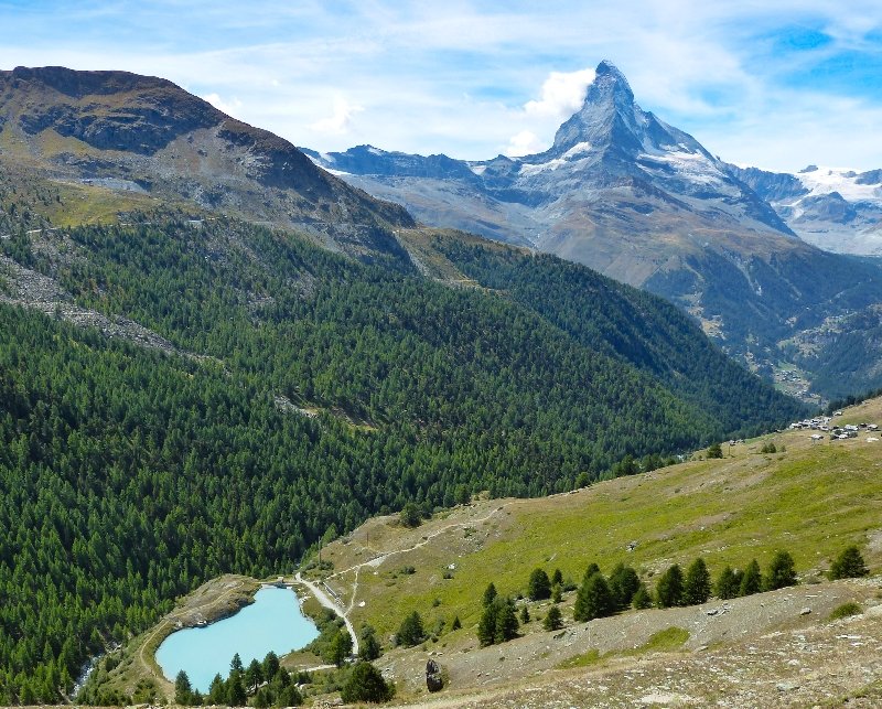
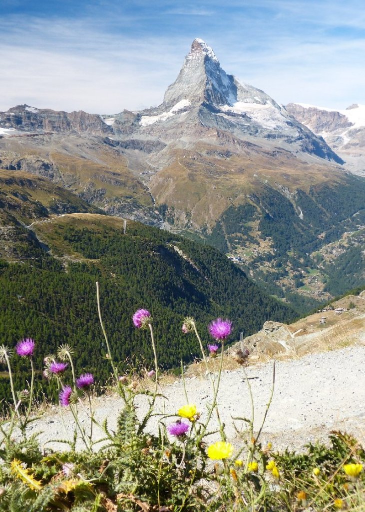
Eines der Fotos von der Wanderung in Zermatt ist nun als Aquarell umgesetzt. Mich haben bei diesem Motiv vor allem die Größenverhältnisse fasziniert, wie winzig der Mensch und seine Gebäude in der grandiosen Bergwelt wirken…
In the meantime, I’ve done this watercolour from a photo taken on our hiking tour near Zermatt. I found this one intriguing because it perfectly shows how tiny man and his buildings look amidst the towering Alps…
Vor 2 Tagen fuhr ich mit meiner Tochter im Glacier Express von Chur nach Zermatt. Den gestrigen Tag waren wir wandern, heute ging es wieder heim. Schon der Blick aus dem Panoramazug war toll, allerdings zeigen die Fotos, die ich aus dem Zug machte, ein paar kleine Spiegelungen, leicht verfälschte Farben und teils Bewegungsunschärfe am unteren Rand. Trotzdem geben sie einen guten Eindruck von der Fahrt. Auf der Wanderung gelangen dafür richtig gute Bilder – geniesst es!
Two days ago I went to Zermatt with my daughter, taking the Glacier Express train. Yesterday, we did a hiking tour, today we went home again. The panoramic train offered great views, while the photos taken from the train show some minor reflections and the colours, too, are a bit changed. Nevertheless, they offer a nice impression of the trip! The photos taken on the hiking tour turned out great, though. So, enjoy!
Oben: Blick in die Rheinschlucht, diese ist autofrei und daher nur vom Zug, mit Rad oder zu Fuss zu besichtigen.
Above: view of the river Rhine canyon. No cars allowed!
Zu den anderen Bildern oben kann ich nicht viel sagen,es gab zwar Infos im Zug, aber nicht zu allem, was man sah..
For the other pictures above I can’t tell you anything because these places weren’t included in the on-board information of the train.
Abendstimmung kurz vor Ankunft in Zermatt…
Evening – shortly before arriving in Zermatt…
Gleich am Abend nahm ich das obere Bild auf, das untere am nächsten Morgen bei Sonnenaufgang.
The same evening I took the picture above, then the next morning just before dawn the one below.
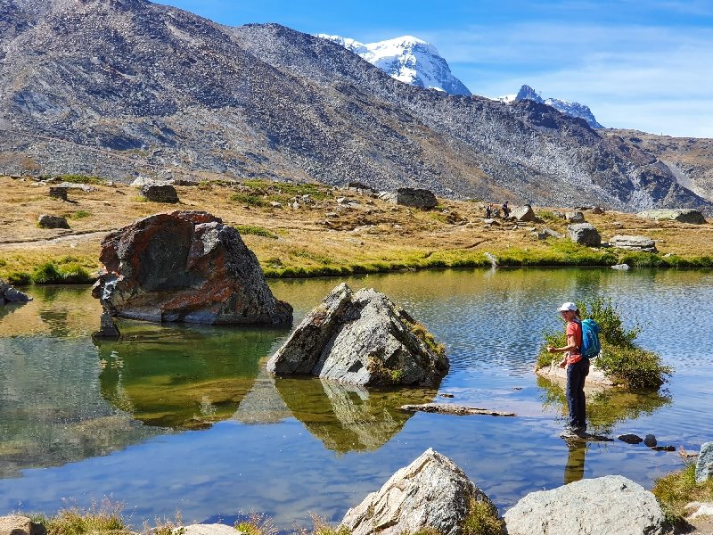
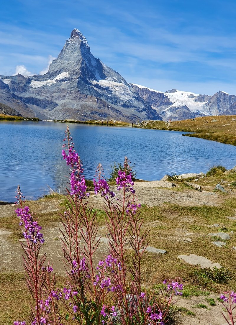
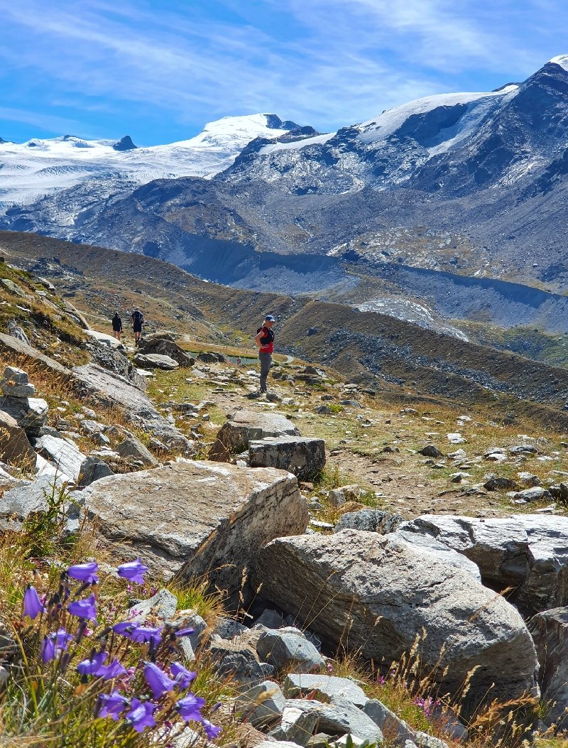
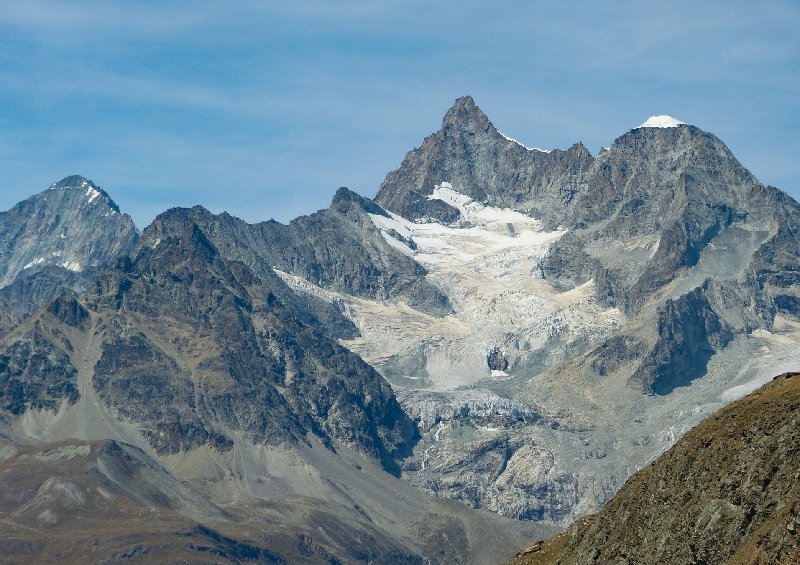
Die nächsten Bilder sind alle von unserer Wanderung: wir gingen sehr gemütlich einen Teil der Seen-Tour; mit Bahnen das Rothorn hinauf bis Blauherd, dann zu Fuß bis zur Fluhalp und im Bogen hinunter zur Bahnstation Sunnega, mit der Zahnradbahn dann ins Tal. Ständig neue Ansichten des über allem thronenden Matterhorns begleiten einen dort oben, doch auch das Adlerhorn oberhalb der Fluhalp ist immer wieder fotogen…
The next pictures have all been taken during our hiking tour: we took a part of the „Lakes“-trail. We went up Rothorn mountain taking first the rack train, then the cable car to „Blauherd“. From there we hiked up to the mountain restaurant „Fluhalp“, then took a wide arc down to the rack train which we again took for our ride down. The whole time we had many different views of the Matterhorn, but „Adlerhorn“ (Eagles Horn) above Fluhalp also made for a great motive…
Am Stellisee/Lake Stelli
Blick auf den Grünsee/ View of the Green Lake
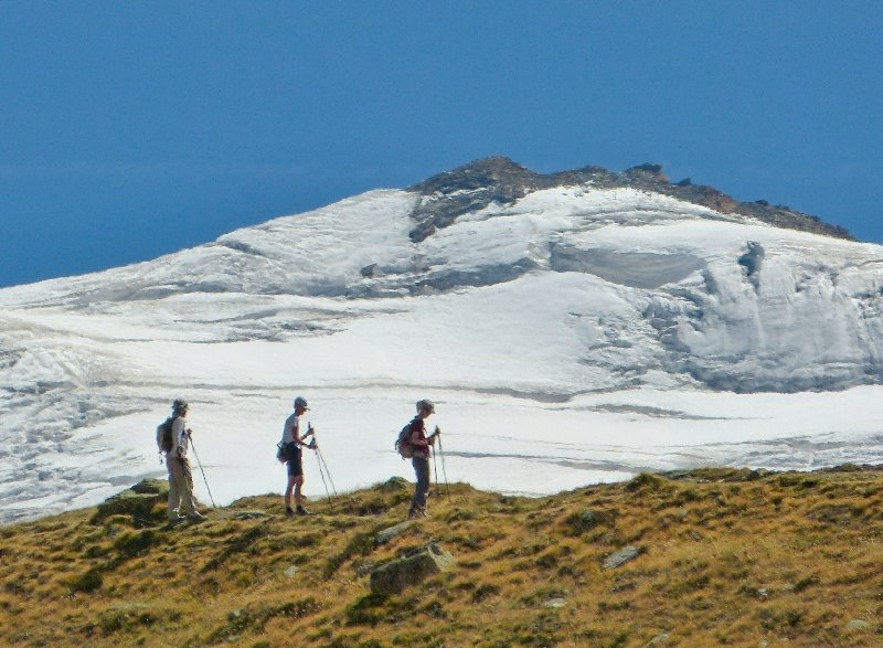
Meine Tochter mit dem roten T-shirt machte sich immer gut auf den Bildern!/My daughter and her red T-shirt were a nice addition to the pictures!Weit entfernte Bergsteiger – mit 500er Tele aufgenommen/far away mountaineers – taken with the tele photo lensDie Fluhalp und das Adlerhorn. Ich nehme an, das Rothorn hat seinen Namen von den in dieser Jahreszeit leuchtend roten Bodendeckern(?)/ Restaurant Fluhalp and Adlerhorn. I imagine, Rothorn (Red Horn) mountain has got its name because of the brushes that are bright red this time of year(?)Ein bißchen Kitsch muss sein😉/just a bit of kitsch is ok, too😉